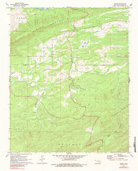
1971 Map of Damon
USGS Topo · Published 1984About this map
Damon serves as the focal point of this rural Oklahoma landscape, situated where the terrain transitions from the heights of Blue Mountain and Gowen Mountain into the drainages of Gaines Creek. The presence of the Veterans Colony south of the main settlement highlights a specific era of communal living and land use in Latimer County. Local history is preserved at the Damon Cem and the Gum Creek Ch, providing important reference points for genealogical research in this sparsely populated region.
Find a feature on this map
21 named features on this map. Tap any name to fly to it.
Don’t see what you’re looking for? This feature index may not catch every label — zoom into the map to look around manually.
Map Details
Editions of this 1971 Damon Map
2 editions found
Other maps of this area

1901 · Tuskahoma
USGS Topo · 1:125,000

1908 · Tuskahoma
USGS Topo · 1:125,000

1909 · Tuskahoma
USGS Topo · 1:125,000

1940 · Red Oak
USGS Topo · 1:62,500

1943 · Red Oak
USGS Topo · 1:62,500

1950 · Mcalester
USGS Topo · 1:250,000

1962 · McAlester
USGS Topo · 1:250,000

1965 · McAlester
USGS Topo · 1:250,000

1971 · Yanush
USGS Topo · 1:24,000

1971 · Kiamichi
USGS Topo · 1:24,000