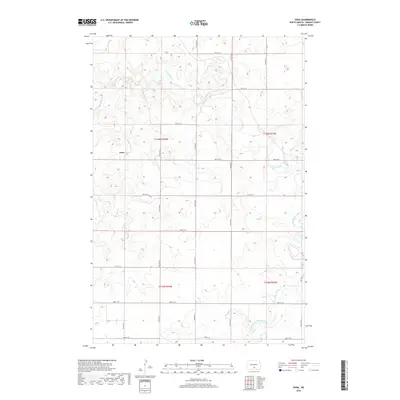
2018 Map of Dana
USGS Topo · Published 2018About this map
Dana sits at the heart of this prairie landscape in Hazelton Township, where the drainages of the Missouri River plateau define the local topography. This 2018 survey shows a rural environment organized by a rigid grid of section-line roads, such as 57th St SE and 11th Ave SE, which slice through the rolling terrain. The area is defined by its seasonal hydrology, with Hawk Cr and Goose Cr carving subtle coulees across the township. Further east and south, the Long Lake Creek system, including the West Branch Long Lake Creek, provides the primary drainage. This map captures the persistent agrarian character of Emmons County in the early 21st century, showing how the original land survey boundaries of T136N R76W and T135N R76W continue to dictate the placement of farmsteads and transport routes in the modern era.
Find a feature on this map
25 named features on this map. Tap any name to fly to it.
Don’t see what you’re looking for? This feature index may not catch every label — zoom into the map to look around manually.
Map Details
Editions of this 2018 Dana Map
This is the sole edition of this map. No revisions or reprints were ever made.
Other maps of this area

1954 · Bismarck
USGS Topo · 1:250,000

1958 · Bismarck
USGS Topo · 1:250,000

1971 · Hazelton
USGS Topo · 1:24,000

1971 · Moffit SE
USGS Topo · 1:24,000

1971 · Moffit
USGS Topo · 1:24,000

1975 · Dana
USGS Topo · 1:24,000

1975 · Appert Lake
USGS Topo · 1:24,000

1975 · Linton NE
USGS Topo · 1:24,000
1975 · Braddock NW
USGS Topo · 1:24,000

1975 · Braddock
USGS Topo · 1:24,000