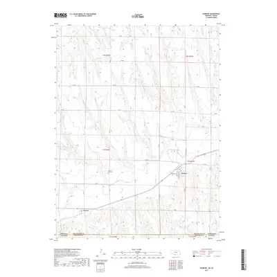
2017 Map of Danbury
USGS Topo · Published 2017About this map
The valley of Beaver Cr defines the settlement patterns along the Nebraska-Kansas border in this southwestern Red Willow County landscape. The village of Danbury serves as the local hub, centered at the intersection of Decatur St and Grandville Ave, while the smaller community of Marion sits just to the west along the same drainage. This area is characterized by the transition from the relatively flat uplands, divided by an orderly grid of rural roads like Rd 708 and Rd 394, to the deeply eroded creek valleys. Local water management is visible through the presence of Gallatin Reservoir and Vanvleet Reservoir. Genealogists will find the Danbury-Marion Cem positioned between the two namesake settlements, preserving the history of these agricultural communities near the state line.
Find a feature on this map
35 named features on this map. Tap any name to fly to it.
Don’t see what you’re looking for? This feature index may not catch every label — zoom into the map to look around manually.
Map Details
Editions of this 2017 Danbury Map
This is the sole edition of this map. No revisions or reprints were ever made.
Other maps of this area

1951 · Oberlin
USGS Topo · 1:62,500

1951 · Kanona
USGS Topo · 1:62,500

1954 · McCook
USGS Topo · 1:250,000

1954 · Goodland
USGS Topo · 1:250,000

1956 · Goodland
USGS Topo · 1:250,000

1957 · McCook
USGS Topo · 1:250,000

1957 · Goodland
USGS Topo · 1:250,000

1957 · Danbury
USGS Topo · 1:24,000

1957 · Lebanon
USGS Topo · 1:24,000

1957 · McCook SE
USGS Topo · 1:24,000