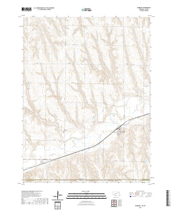
2021 Map of Danbury
USGS Topo · Published 2021About this map
Danbury and Marion occupy the southern reaches of Red Willow County in this 2021 study, situated just north of the Nebraska-Kansas state line. The landscape is defined by the winding course of Beaver Cr and Buffalo Cr, which carve through the high plains terrain. Local infrastructure is anchored by a grid of rural routes like RD 709 and RD 707, while the village of Danbury is detailed with street-level precision along Fairpoint Ave and Grandville Ave. Water management is evident through the Gallatin Reservoir and Vanvleet Reservoir, which support the agricultural character of the region. For those tracing local heritage, the Danbury - Marion Cem serves as a central landmark between the two namesake settlements, marking the shared history of these rural communities as they cross the divide between Red Willow and Decatur counties.
Find a feature on this map
27 named features on this map. Tap any name to fly to it.
Don’t see what you’re looking for? This feature index may not catch every label — zoom into the map to look around manually.
Map Details
Editions of this 2021 Danbury Map
This is the sole edition of this map. No revisions or reprints were ever made.
Other maps of this area

1951 · Oberlin
USGS Topo · 1:62,500

1951 · Kanona
USGS Topo · 1:62,500

1954 · McCook
USGS Topo · 1:250,000

1954 · Goodland
USGS Topo · 1:250,000

1956 · Goodland
USGS Topo · 1:250,000

1957 · McCook
USGS Topo · 1:250,000

1957 · Goodland
USGS Topo · 1:250,000

1957 · Danbury
USGS Topo · 1:24,000

1957 · Lebanon
USGS Topo · 1:24,000

1957 · McCook SE
USGS Topo · 1:24,000