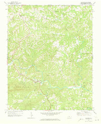
1971 Map of Danbury
USGS Topo · Published 1973About this map
The Dan River carves a winding path through the heart of Stokes County, anchoring a landscape defined by sharp ridges and deep creek valleys. In the early 1970s, the town of Danbury serves as a central hub, situated just east of the expansive Hanging Rock State Park. The map reveals a rural community supported by a network of small settlements like Lawsonville, Snow Hill, and Hartman. Dozens of unnamed family cemeteries are scattered across the terrain, reflecting the long-standing genealogical roots of the area, while local social life centers on institutions such as Spencer-Hill Memorial Ch, North View Ch, and Davis Chapel. Economic activity is represented by a Quarry near the river bend and infrastructure including a Hospital and Water Tank in the county seat. This period shows the transition from isolated homesteads to more integrated rural routes before later development altered the local character.
Find a feature on this map
35 named features on this map. Tap any name to fly to it.
Don’t see what you’re looking for? This feature index may not catch every label — zoom into the map to look around manually.
Map Details
Editions of this 1971 Danbury Map
2 editions found
Other maps of this area

1926 · Critz
USGS Topo · 1:48,000

1928 · Stuart
USGS Topo · 1:48,000

1928 · Critz
USGS Topo · 1:62,500

1931 · Stuart
USGS Topo · 1:62,500

1953 · Winston-Salem
USGS Topo · 1:250,000

1955 · Winston-Salem
USGS Topo · 1:250,000

1962 · Winston-Salem
USGS Topo · 1:250,000

1964 · Hanging Rock
USGS Topo · 1:24,000

1964 · King
USGS Topo · 1:24,000
1967 · Spencer
USGS Topo · 1:24,000