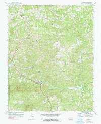
1971 Map of Danbury
USGS Topo · Published 1990About this map
The Dan River meanders across this Stokes County landscape, cutting a path through the rolling terrain south of the Virginia border. The village of Danbury serves as a focal point near the river's bend, while smaller settlements like Lawsonville and Snow Hill are established along the northern ridges. This 1971 record of the area reflects a deeply rooted rural community, evidenced by the numerous country churches such as Spencer-Hill Memorial Ch, North View Ch, and Davis Chapel that anchor the local crossroads.
Find a feature on this map
34 named features on this map. Tap any name to fly to it.
Don’t see what you’re looking for? This feature index may not catch every label — zoom into the map to look around manually.
Map Details
Editions of this 1971 Danbury Map
2 editions found
Other maps of this area

1926 · Critz
USGS Topo · 1:48,000

1928 · Stuart
USGS Topo · 1:48,000

1928 · Critz
USGS Topo · 1:62,500

1931 · Stuart
USGS Topo · 1:62,500

1953 · Winston-Salem
USGS Topo · 1:250,000

1955 · Winston-Salem
USGS Topo · 1:250,000

1962 · Winston-Salem
USGS Topo · 1:250,000

1964 · Hanging Rock
USGS Topo · 1:24,000

1964 · King
USGS Topo · 1:24,000
1967 · Spencer
USGS Topo · 1:24,000