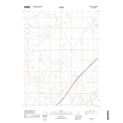
2020 Map of Danish Flat
USGS Topo · Published 2020About this map
Danish Flat and the surrounding high desert plateau of Grand County are defined here by a network of resource extraction and transit routes. The settlement at Agate and the nearby Agate Siding along the Railroad emphasize the importance of industrial logistics in this arid landscape. The map reveals an active energy landscape, notably the Agate Oil Field and numerous water sources essential for remote operations, such as Jims Well and Broadhead Well. Topographically, the area transitions from the broad expanse of Grand Valley toward the prominent elevation of Cisco Mesa. Drainage patterns are marked by Cottonwood Wash and Cisco Wash, which cut through the terrain. A complex system of local roads, including the Straight Shot and Cisco Springs Rd, connects these isolated infrastructure points across the desert.
Find a feature on this map
19 named features on this map. Tap any name to fly to it.
Don’t see what you’re looking for? This feature index may not catch every label — zoom into the map to look around manually.
Map Details
Editions of this 2020 Danish Flat Map
This is the sole edition of this map. No revisions or reprints were ever made.
Other maps of this area

1885 · East Tavaputs
USGS Topo · 1:250,000

1885 · La Sal
USGS Topo · 1:250,000

1954 · Westwater 4 SW
USGS Topo · 1:24,000

1954 · Mt. Waas 1 NW
USGS Topo · 1:24,000

1954 · Coates Creek
USGS Topo · 1:62,500

1956 · Moab
USGS Topo · 1:250,000

1956 · Grand Junction
USGS Topo · 1:250,000

1958 · Cisco
USGS Topo · 1:62,500

1959 · Grand Junction
USGS Topo · 1:250,000

1959 · Moab
USGS Topo · 1:250,000