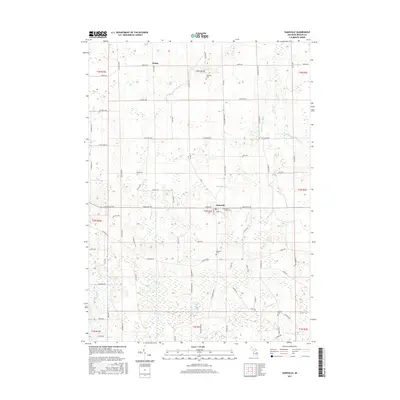
2017 Map of Dansville
USGS Topo · Published 2017About this map
Dansville serves as the primary hub of this agricultural landscape in Ingham County, where a dense network of country roads meets the complex drainage systems of the region. The map reveals an intricate hydrological pattern defined by the Doan Deer Cr and numerous managed waterways like Francis Drain and Hayhoe Drain, which channel water through the township toward Hewes Lake and Ewers Lake. This 2017 data reflects the enduring rural character of Ingham Township, preserving the locations of several ancestral burial grounds including Fairview Cem on the edge of the village and the more isolated Spalding Cem to the north. Genealogists can also trace the historical footprint of Pollok and family-named landmarks such as Reeves Cem, illustrating how the township's development remained tied to its original section lines and small creek valleys like Batleese Cr and Cahaogan Cr.
Find a feature on this map
85 named features on this map. Tap any name to fly to it.
Don’t see what you’re looking for? This feature index may not catch every label — zoom into the map to look around manually.
Map Details
Editions of this 2017 Dansville Map
This is the sole edition of this map. No revisions or reprints were ever made.
Other maps of this area

1908 · Fowlerville
USGS Topo · 1:62,500

1909 · Mason
USGS Topo · 1:62,500

1910 · Fowlerville
USGS Topo · 1:62,500

1911 · Mason
USGS Topo · 1:62,500

1919 · Stockbridge
USGS Topo · 1:62,500

1919 · Rives Junction
USGS Topo · 1:62,500

1921 · Rives Junction
USGS Topo · 1:62,500

1922 · Stockbridge
USGS Topo · 1:62,500

1942 · Stockbridge
USGS Topo · 1:62,500

1958 · Grand Rapids
USGS Topo · 1:250,000