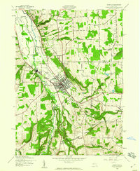
1942 Map of Dansville
USGS Topo · Published 1960About this map
Dansville sits at the confluence of several significant valleys, serving as a hub for both rail and aviation in the early 1940s. The village is anchored by the Dansville Airport and a network of railways including the Delaware Lackawanna and Western and the Pittsburg Shawmut and Northern. This survey reveals a deeply established community with numerous civic anchors like Green Mount Cemetery, Holy Cross Cem, and several numbered rural schools such as School No 5 and School No 2.
Find a feature on this map
54 named features on this map. Tap any name to fly to it.
Don’t see what you’re looking for? This feature index may not catch every label — zoom into the map to look around manually.
Map Details
Editions of this 1942 Dansville Map
5 editions found
Other maps of this area

1902 · Wayland
USGS Topo · 1:62,500

1904 · Wayland
USGS Topo · 1:62,500

1905 · Nunda
USGS Topo · 1:62,500

1915 · Hornell
USGS Topo · 1:62,500

1916 · Canaseraga
USGS Topo · 1:62,500

1918 · Hornell
USGS Topo · 1:62,500

1940 · Canaseraga
USGS Topo · 1:62,500

1942 · Springwater
USGS Topo · 1:31,680

1942 · Wayland
USGS Topo · 1:31,680

1942 · Dansville
USGS Topo · 1:31,680