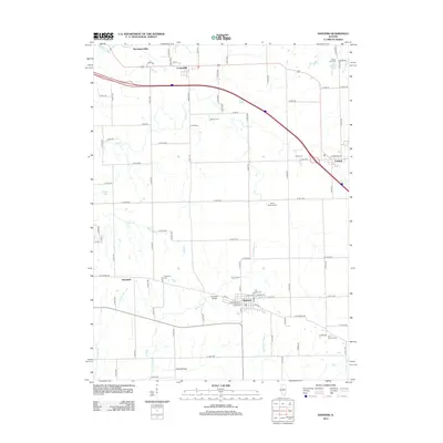
2012 Map of Danvers
USGS Topo · Published 2012About this map
Danvers sits at the heart of this agricultural landscape in McLean County, where the regular geometry of section roads meets the winding drainage of W Fork Sugar Cr. This 2012 snapshot of the region shows a high density of small family and community burial grounds, such as Maurer Cem, Imhoff Cem, and Wintz Cem, which often mark the locations of early area homesteads. To the north, the Mackinaw River cuts through the Mackinaw Dells, offering a sharp contrast in topography compared to the surrounding prairie. The map details the village of Congerville near the river and Carlock to the east, both tied together by modern transportation corridors that parallel the older rural routes. For genealogists, the map is particularly useful for identifying established landmarks like the Habecker Bridge and the Fluegel Bridge, which cross the various forks of Sugar Creek.
Find a feature on this map
93 named features on this map. Tap any name to fly to it.
Don’t see what you’re looking for? This feature index may not catch every label — zoom into the map to look around manually.
Map Details
Editions of this 2012 Danvers Map
This is the sole edition of this map. No revisions or reprints were ever made.
Other maps of this area

1927 · Danvers
USGS Topo · 1:62,500

1928 · Mackinaw
USGS Topo · 1:62,500

1930 · Danvers
USGS Topo · 1:62,500

1932 · Mackinaw
USGS Topo · 1:62,500

1949 · Mc Lean
USGS Topo · 1:62,500

1951 · McLean
USGS Topo · 1:62,500

1951 · Minier
USGS Topo · 1:62,500

1958 · Peoria
USGS Topo · 1:250,000

1961 · Peoria
USGS Topo · 1:250,000

1963 · Peoria
USGS Topo · 1:250,000