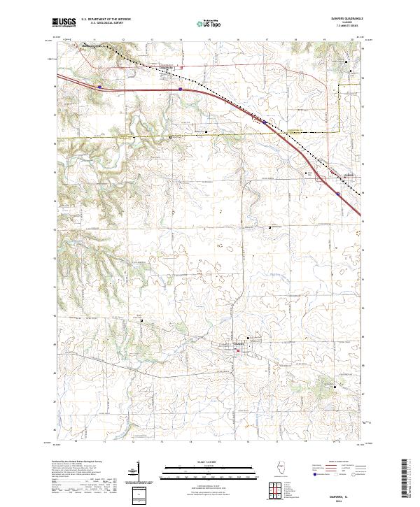
2024 Map of Danvers
USGS Topo · Published 2024About this map
The boundary between Woodford Co and McLean Co divides this Central Illinois landscape, where the agricultural grid is interrupted by the winding corridors of West Fork Sugar Creek and Rock Creek. This 2024 survey documents the established settlements of Danvers, Congerville, and Carlock, each serving as a local hub for the surrounding farmstead network. The map reveals a high concentration of burial sites, reflecting the deep-rooted pioneer history of the area through markers such as Stouts Grove Cem, Hall Barnard Cem, and the Carlock Democrat Cem.
Find a feature on this map
90 named features on this map. Tap any name to fly to it.
Don’t see what you’re looking for? This feature index may not catch every label — zoom into the map to look around manually.
Map Details
Editions of this 2024 Danvers Map
This is the sole edition of this map. No revisions or reprints were ever made.
Other maps of this area

1927 · Danvers
USGS Topo · 1:62,500

1928 · Mackinaw
USGS Topo · 1:62,500

1930 · Danvers
USGS Topo · 1:62,500

1932 · Mackinaw
USGS Topo · 1:62,500

1949 · Mc Lean
USGS Topo · 1:62,500

1951 · McLean
USGS Topo · 1:62,500

1951 · Minier
USGS Topo · 1:62,500

1958 · Peoria
USGS Topo · 1:250,000

1961 · Peoria
USGS Topo · 1:250,000

1963 · Peoria
USGS Topo · 1:250,000