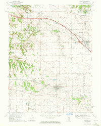
1970 Map of Danvers
USGS Topo · Published 1972About this map
Danvers and the neighboring village of Carlock sit at the intersection of early rail lines and modern interstate infrastructure in McLean County. The landscape is defined by the drainage of Rock Creek and White Oak Creek as they flow toward the Mackinaw River in the northwest. This 1970 field-check reveals a region in transition, where the Norfolk and Western and Penn Central railroads parallel the newer corridor of Interstate 74.
Find a feature on this map
36 named features on this map. Tap any name to fly to it.
Don’t see what you’re looking for? This feature index may not catch every label — zoom into the map to look around manually.
Map Details
Editions of this 1970 Danvers Map
This is the sole edition of this map. No revisions or reprints were ever made.
Other maps of this area

1927 · Danvers
USGS Topo · 1:62,500

1928 · Mackinaw
USGS Topo · 1:62,500

1930 · Danvers
USGS Topo · 1:62,500

1932 · Mackinaw
USGS Topo · 1:62,500

1949 · Mc Lean
USGS Topo · 1:62,500

1951 · McLean
USGS Topo · 1:62,500

1951 · Minier
USGS Topo · 1:62,500

1958 · Peoria
USGS Topo · 1:250,000

1961 · Peoria
USGS Topo · 1:250,000

1963 · Peoria
USGS Topo · 1:250,000