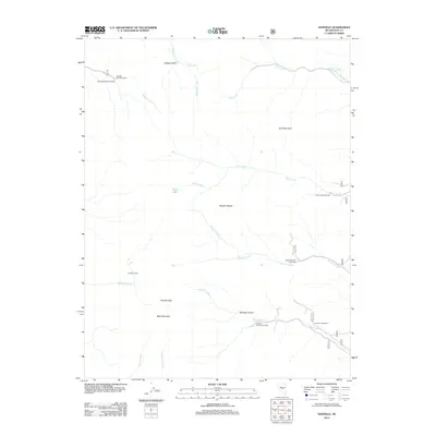
2012 Map of Danville
USGS Topo · Published 2012About this map
The Danville (historical) site and George Camp anchor this study of the eastern Monitor Range in Nye County. This high-altitude landscape is defined by the steep drainages of Danville Canyon and the prominent elevations of Table Mountain and Tulle Mountain. The map details the complex drainage systems that feed into the basin, including Wadsworth Creek, Tulle Creek, and Sawmill Creek, alongside smaller features like Clear Lake and Morgan Spring.
Find a feature on this map
23 named features on this map. Tap any name to fly to it.
Don’t see what you’re looking for? This feature index may not catch every label — zoom into the map to look around manually.
Map Details
Editions of this 2012 Danville Map
This is the sole edition of this map. No revisions or reprints were ever made.
Other maps of this area

1956 · Tonopah
USGS Topo · 1:250,000

1959 · Tonopah
USGS Topo · 1:250,000

1962 · Tonopah
USGS Topo · 1:250,000

1967 · Upper Fish Lake
USGS Topo · 1:24,000

1968 · Morey Peak
USGS Topo · 1:62,500

1968 · Fish Springs
USGS Topo · 1:62,500
1968 · Stargo Creek
USGS Topo · 1:24,000
1968 · Fish Springs
USGS Topo · 1:24,000

1971 · Barley Creek
USGS Topo · 1:24,000

1971 · Mosquito Creek
USGS Topo · 1:24,000