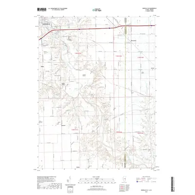
2018 Map of Danville SE
USGS Topo · Published 2018About this map
The Vermilion River carves a winding path through this portion of the Illinois and Indiana borderlands, defining the local geography as it flows past Langley Bottom. On the Illinois side, the southern edge of Danville and the town of Tilton give way to smaller settlements like Grape Creek, Himrod, and Meeks. This map is particularly valuable for genealogists, as it identifies over a dozen burial sites scattered across the landscape, including Atherton Cem, the McKendree Cem, and the Saints Peter and Paul Cem. East across the state line in Indiana, the terrain shifts near Gessie and Rileysburg, where the Gessie Airport and several small creeks like Coal Br and Spring Cr drain the rural countryside. The network of county roads, such as Perrysville Rd and Co Hwy 504, connects these isolated farmsteads and historic family cemeteries.
Find a feature on this map
133 named features on this map. Tap any name to fly to it.
Don’t see what you’re looking for? This feature index may not catch every label — zoom into the map to look around manually.
Map Details
Editions of this 2018 Danville SE Map
This is the sole edition of this map. No revisions or reprints were ever made.
Other maps of this area

1899 · Danville
USGS Topo · 1:62,500

1900 · Danville
USGS Topo · 1:62,500

1947 · Ridge Farm
USGS Topo · 1:62,500

1948 · Danville NW
USGS Topo · 1:24,000

1949 · Danville SW
USGS Topo · 1:24,000

1950 · Danville SW
USGS Topo · 1:24,000

1950 · Danville NW
USGS Topo · 1:24,000

1950 · Danville SE
USGS Topo · 1:24,000

1950 · Danville NE
USGS Topo · 1:24,000

1951 · Danville NE
USGS Topo · 1:24,000