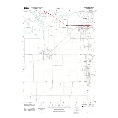
2012 Map of Danville SW
USGS Topo · Published 2012About this map
The Middle Fork Vermilion River and Salt Fork converge here, carving a valley where industry and settlement have long overlapped. West of South Danville, the landscape is dotted with several small water bodies like Missionfield Pond and Doughnut Pond, remnants of the region's surface mining history. The village of Catlin serves as a local hub, surrounded by a high density of small burial grounds that reflect the area's diverse ethnic and family heritage, including Lithuanian Cem, Saints Peter and Paul Cem, and the Wright Family Cem. Smaller settlements such as Kellyville, Unionville, and Hegeler line the eastern corridor, while the north is marked by the broad expanse of Thompson Hollow. This layout highlights the transition from the denser outskirts of Danville to the organized agricultural grid and scattered industrial hamlets of Vermilion County.
Find a feature on this map
167 named features on this map. Tap any name to fly to it.
Don’t see what you’re looking for? This feature index may not catch every label — zoom into the map to look around manually.
Map Details
Editions of this 2012 Danville SW Map
This is the sole edition of this map. No revisions or reprints were ever made.
Other maps of this area

1899 · Danville
USGS Topo · 1:62,500

1900 · Danville
USGS Topo · 1:62,500

1931 · Fithian
USGS Topo · 1:48,000

1943 · Fithian
USGS Topo · 1:62,500

1947 · Ridge Farm
USGS Topo · 1:62,500

1948 · Danville NW
USGS Topo · 1:24,000

1949 · Danville SW
USGS Topo · 1:24,000

1950 · Danville SW
USGS Topo · 1:24,000

1950 · Danville NW
USGS Topo · 1:24,000

1950 · Danville SE
USGS Topo · 1:24,000