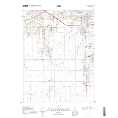
2018 Map of Danville SW
USGS Topo · Published 2018About this map
The Vermilion River and Middle Fork Vermilion River converge near Batestown, shaping a landscape where industrial footprints and rural burial grounds coexist. This 2018 survey captures the dense development south of Danville, where the communities of Westville, Belgium, and Tilton form a contiguous corridor of residential and commercial activity. The area is particularly rich in genealogical data, preserving the locations of numerous family and church burial sites, from the Wright Family Cem and Pate Cem to the Lithuanian Cem. To the west, the village of Catlin serves as a hub for the more agricultural sections of the quadrangle, which are marked by drainage systems like Fayette Drain and the prominent Woodland Ridge Cem. The presence of Missionfield Pond and Doughnut Pond suggests the legacy of former surface mining operations common to this region of Vermilion County.
Find a feature on this map
142 named features on this map. Tap any name to fly to it.
Don’t see what you’re looking for? This feature index may not catch every label — zoom into the map to look around manually.
Map Details
Editions of this 2018 Danville SW Map
This is the sole edition of this map. No revisions or reprints were ever made.
Other maps of this area

1899 · Danville
USGS Topo · 1:62,500

1900 · Danville
USGS Topo · 1:62,500

1931 · Fithian
USGS Topo · 1:48,000

1943 · Fithian
USGS Topo · 1:62,500

1947 · Ridge Farm
USGS Topo · 1:62,500

1948 · Danville NW
USGS Topo · 1:24,000

1949 · Danville SW
USGS Topo · 1:24,000

1950 · Danville SW
USGS Topo · 1:24,000

1950 · Danville NW
USGS Topo · 1:24,000

1950 · Danville SE
USGS Topo · 1:24,000