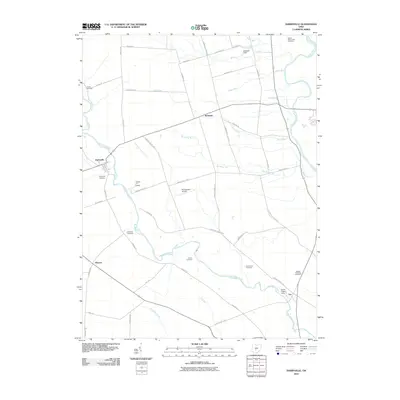
2010 Map of Darbyville
USGS Topo · Published 2010About this map
Big Darby Creek meanders through this agricultural landscape of Pickaway County, Ohio, defining much of the drainage pattern as it flows southeast toward the Scioto River. The map highlights a series of small rural settlements including Darbyville, Robtown, and Fox, connected by a network of established local routes like Florence Chapel Pike and London Road. This 2010 survey is particularly significant for genealogists, as it documents numerous family and local burial grounds scattered across the farmland, including the James Borrer Farm Cemetery and Gulick Cemetery. Private aviation is also a notable presence here, with several landing fields such as Ronshausen Airport and the uniquely named Clarks Dream Strip providing air access to these central Ohio fields.
Find a feature on this map
51 named features on this map. Tap any name to fly to it.
Don’t see what you’re looking for? This feature index may not catch every label — zoom into the map to look around manually.
Map Details
Editions of this 2010 Darbyville Map
This is the sole edition of this map. No revisions or reprints were ever made.
Other maps of this area

1911 · Era
USGS Topo · 1:62,500

1913 · Era
USGS Topo · 1:62,500

1914 · Circleville
USGS Topo · 1:62,500

1923 · West Columbus
USGS Topo · 1:62,500

1925 · East Columbus
USGS Topo · 1:62,500

1925 · West Columbus
USGS Topo · 1:62,500

1943 · Era
USGS Topo · 1:62,500

1943 · Circleville
USGS Topo · 1:62,500

1943 · East Columbus
USGS Topo · 1:62,500

1947 · Columbus
USGS Topo · 1:250,000