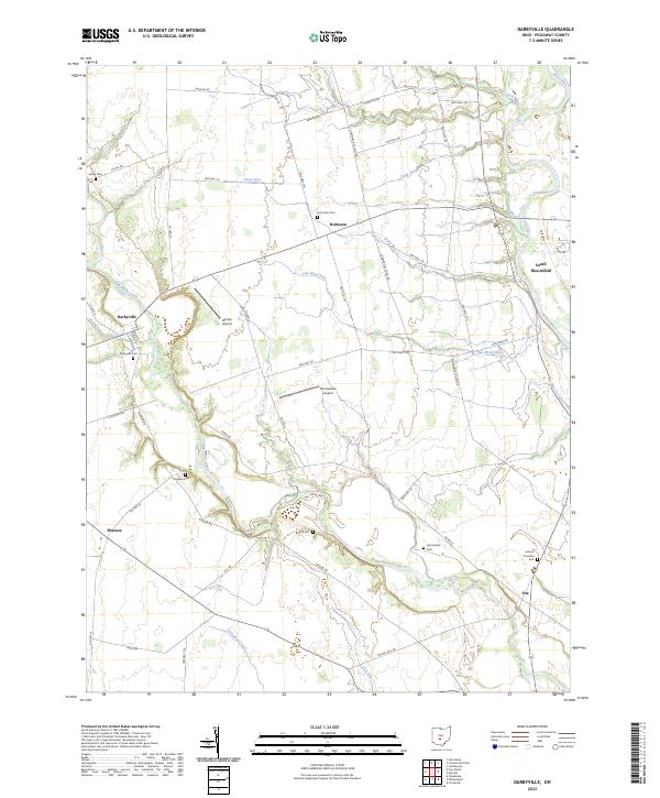
2023 Map of Darbyville
USGS Topo · Published 2023About this map
Big Darby Creek carves a winding path through this central Ohio landscape, anchoring a rural corridor defined by long-standing family cemeteries and small settlements. The village of Darbyville sits at a prominent bend in the creek, while the Scioto River defines the eastern boundary near South Bloomfield. This terrain is deeply marked by its agricultural history and local lineage, as evidenced by several family-named burial grounds like Hott Farm Cem, Renick Cem, and Florence Cem scattered across the township.
Find a feature on this map
57 named features on this map. Tap any name to fly to it.
Don’t see what you’re looking for? This feature index may not catch every label — zoom into the map to look around manually.
Map Details
Editions of this 2023 Darbyville Map
This is the sole edition of this map. No revisions or reprints were ever made.
Other maps of this area

1911 · Era
USGS Topo · 1:62,500

1913 · Era
USGS Topo · 1:62,500

1914 · Circleville
USGS Topo · 1:62,500

1923 · West Columbus
USGS Topo · 1:62,500

1925 · East Columbus
USGS Topo · 1:62,500

1925 · West Columbus
USGS Topo · 1:62,500

1943 · Era
USGS Topo · 1:62,500

1943 · Circleville
USGS Topo · 1:62,500

1943 · East Columbus
USGS Topo · 1:62,500

1947 · Columbus
USGS Topo · 1:250,000