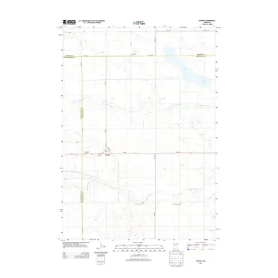
2013 Map of Darfur
USGS Topo · Published 2013About this map
Darfur sits at the intersection of MN-30 and Co HWY-4, serving as the primary hub in this agricultural region where Brown, Cottonwood, and Watonwan Counties meet. The landscape is defined by the winding course of the N Fork Watonwan River and the Watonwan River, which cut through the prairie and feed into local water bodies like Wood Lake and Ewy Lake. This 2013 survey provides a detailed look at the rural distribution of religious and commemorative sites, documenting the Saint Johns Cem, Bethlehem Cem, and Salem Cem. The presence of the First Mennonite Cem and the Haseman Post Cem underscores the area's deep-rooted denominational heritage and the importance of localized burial grounds in maintaining family histories within the township structure.
Find a feature on this map
35 named features on this map. Tap any name to fly to it.
Don’t see what you’re looking for? This feature index may not catch every label — zoom into the map to look around manually.
Map Details
Editions of this 2013 Darfur Map
This is the sole edition of this map. No revisions or reprints were ever made.
Other maps of this area

1953 · New Ulm
USGS Topo · 1:250,000

1954 · Fairmont
USGS Topo · 1:250,000

1957 · New Ulm
USGS Topo · 1:250,000

1958 · New Ulm
USGS Topo · 1:250,000

1958 · Fairmont
USGS Topo · 1:250,000

1967 · New Ulm
USGS Topo · 1:250,000

1967 · Lake Hanska West
USGS Topo · 1:24,000

1967 · Springfield
USGS Topo · 1:24,000

1967 · Godahl
USGS Topo · 1:24,000

1967 · Darfur
USGS Topo · 1:24,000