
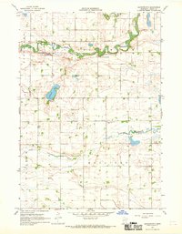
1967 Map of Springfield
USGS Topo · Published 1968About this map
Springfield dominates the northern landscape of this survey, situated where the Chicago and North Western rail line parallels the winding path of the Cottonwood River. Industrial activity is evident along the riverbanks near the town, where a Claypit and Kilns suggest local brick or ceramic production. Beyond the municipal limits, the terrain transitions into the agricultural townships of Burns Town and Bashaw, characterized by numerous gravel pits and specialized land use such as the Bashaw State Wildlife Management Area. To the southwest, the small settlement of Dotson sits near Mound Creek, while genealogists can find several burial sites including Springfield Cem, Moravian Cem, and Faith Cem. The presence of the Reed Lakebed and the southern Little Cottonwood River further illustrate the distinct drainage patterns of this Brown County region during the late 1960s.
Find a feature on this map
22 named features on this map. Tap any name to fly to it.
Don’t see what you’re looking for? This feature index may not catch every label — zoom into the map to look around manually.
Map Details
Editions of this 1967 Springfield Map
This is the sole edition of this map. No revisions or reprints were ever made.
Other maps of this area

1953 · Morgan
USGS Topo · 1:62,500

1953 · New Ulm
USGS Topo · 1:250,000

1957 · New Ulm
USGS Topo · 1:250,000

1958 · New Ulm
USGS Topo · 1:250,000

1967 · New Ulm
USGS Topo · 1:250,000

1967 · Clements SE
USGS Topo · 1:24,000

1967 · Sanborn SE
USGS Topo · 1:24,000

1967 · Sanborn NE
USGS Topo · 1:24,000

1967 · Darfur
USGS Topo · 1:24,000
1967 · Leavenworth
USGS Topo · 1:24,000