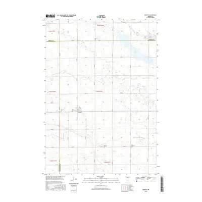
2016 Map of Darfur
USGS Topo · Published 2016About this map
Darfur anchors this southwestern Minnesota landscape, situated at the intersection of a sprawling rural road network and the surrounding agricultural plains. The town's local history is well-preserved through several nearby burial sites, including Saint Johns Cem and Bethlehem Cem just to the west, while Salem Cem sits further north along the county line. The map highlights a complex hydrography dominated by the N Fork Watonwan River and the main Watonwan River, which meander through the southern and central sections of the quadrangle. Significant water features like Wood Lake provide a distinct contrast to the gridded townships. Genealogists and researchers can trace lineage through distinct rural markers such as the Haseman Post Cem and the First Mennonite Cem, which are located near Co Hwy 11 in the southern part of the survey area.
Find a feature on this map
32 named features on this map. Tap any name to fly to it.
Don’t see what you’re looking for? This feature index may not catch every label — zoom into the map to look around manually.
Map Details
Editions of this 2016 Darfur Map
This is the sole edition of this map. No revisions or reprints were ever made.
Other maps of this area

1953 · New Ulm
USGS Topo · 1:250,000

1954 · Fairmont
USGS Topo · 1:250,000

1957 · New Ulm
USGS Topo · 1:250,000

1958 · New Ulm
USGS Topo · 1:250,000

1958 · Fairmont
USGS Topo · 1:250,000

1967 · New Ulm
USGS Topo · 1:250,000

1967 · Lake Hanska West
USGS Topo · 1:24,000

1967 · Springfield
USGS Topo · 1:24,000

1967 · Godahl
USGS Topo · 1:24,000

1967 · Darfur
USGS Topo · 1:24,000