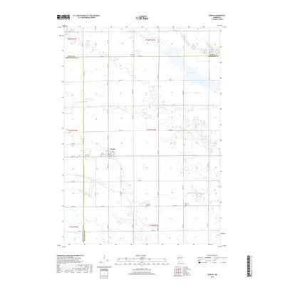
2019 Map of Darfur
USGS Topo · Published 2019About this map
Darfur anchors this southwestern Minnesota agricultural landscape at the junction of several county roads, serving as a focal point for the surrounding prairie townships. The drainage of the Watonwan River and its N Fork Watonwan River meanders across the territory, defining the local topography and creating natural boundaries between the flat cultivated fields. In the northern section, Wood Lake provides a significant water feature amidst the sectional grid of the Public Land Survey System. The map reveals a deeply rooted rural community, marked by numerous small cemeteries that suggest early pioneer settlement patterns and denominational history, including the First Mennonite Cem and Saint Johns Cem. The precise alignment of roads like Co HWY 1 and Co RD 17 highlights the enduring importance of the township and range system in organizing the land and its rural infrastructure.
Find a feature on this map
36 named features on this map. Tap any name to fly to it.
Don’t see what you’re looking for? This feature index may not catch every label — zoom into the map to look around manually.
Map Details
Editions of this 2019 Darfur Map
This is the sole edition of this map. No revisions or reprints were ever made.
Other maps of this area

1953 · New Ulm
USGS Topo · 1:250,000

1954 · Fairmont
USGS Topo · 1:250,000

1957 · New Ulm
USGS Topo · 1:250,000

1958 · New Ulm
USGS Topo · 1:250,000

1958 · Fairmont
USGS Topo · 1:250,000

1967 · New Ulm
USGS Topo · 1:250,000

1967 · Lake Hanska West
USGS Topo · 1:24,000

1967 · Springfield
USGS Topo · 1:24,000

1967 · Godahl
USGS Topo · 1:24,000

1967 · Darfur
USGS Topo · 1:24,000