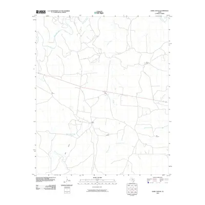
2010 Map of Dark Canyon
USGS Topo · Published 2010About this map
South Wichita River and Newman Creek define the drainage patterns of this rural ranching landscape in King County. The map details the network of ephemeral waterways and canyon systems, including the namesake Dark Canyon and North Croton Creek to the south. Human footprint is sparse but specific to the cattle industry, marked by landmarks such as Bateman Ranch and small settlements like Eight Camp and Pickett Pens. The presence of scattered water infrastructure, including Ash Windmill, Lobo Windmill, and Dark Canyon Tank, highlights the critical role of water management in this arid stretch of North Texas. County roads like Co RD 257 and Co RD 328 provide the primary connections across the undulating terrain, linking isolated ranching operations to the wider region.
Find a feature on this map
19 named features on this map. Tap any name to fly to it.
Don’t see what you’re looking for? This feature index may not catch every label — zoom into the map to look around manually.
Map Details
Editions of this 2010 Dark Canyon Map
This is the sole edition of this map. No revisions or reprints were ever made.
Other maps of this area

1954 · Lubbock
USGS Topo · 1:250,000

1959 · Bob Creek
USGS Topo · 1:24,000

1966 · Ox Yoke Creek
USGS Topo · 1:24,000

1966 · J Y Ranch
USGS Topo · 1:24,000

1967 · Dark Canyon
USGS Topo · 1:24,000

1967 · Fourmile Hill
USGS Topo · 1:24,000

1967 · Kiowa Peak NW
USGS Topo · 1:24,000

1967 · Kiowa Peak NE
USGS Topo · 1:24,000
1967 · Buzzard Peak
USGS Topo · 1:24,000

1968 · Guthrie
USGS Topo · 1:24,000