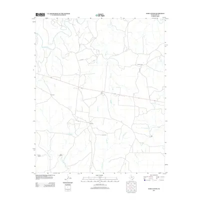
2012 Map of Dark Canyon
USGS Topo · Published 2012About this map
The S Wichita River winds through the northern portion of this King County landscape, which is defined by its deep drainage networks and ranching outposts. This territory is characterized by its named canyons, most notably Dark Canyon and Spring Canyon in the southwest, where the land drops away into the N Croton Cr basin. Settlement is sparse, represented by functional hubs like Eight Camp, Bateman Ranch, and Pickett Pens, reflecting the large-scale cattle operations of the early 21st century. Water management is the primary human imprint on the terrain, evidenced by a network of windmills and reservoirs including the Ash Windmill, Lobo Windmill, and Dark Canyon Tank. These features, along with several county roads, provide the essential infrastructure for navigating this arid and dissected region of the Texas Panhandle-Plains.
Find a feature on this map
20 named features on this map. Tap any name to fly to it.
Don’t see what you’re looking for? This feature index may not catch every label — zoom into the map to look around manually.
Map Details
Editions of this 2012 Dark Canyon Map
This is the sole edition of this map. No revisions or reprints were ever made.
Other maps of this area

1954 · Lubbock
USGS Topo · 1:250,000

1959 · Bob Creek
USGS Topo · 1:24,000

1966 · Ox Yoke Creek
USGS Topo · 1:24,000

1966 · J Y Ranch
USGS Topo · 1:24,000

1967 · Dark Canyon
USGS Topo · 1:24,000

1967 · Fourmile Hill
USGS Topo · 1:24,000

1967 · Kiowa Peak NW
USGS Topo · 1:24,000

1967 · Kiowa Peak NE
USGS Topo · 1:24,000
1967 · Buzzard Peak
USGS Topo · 1:24,000

1968 · Guthrie
USGS Topo · 1:24,000