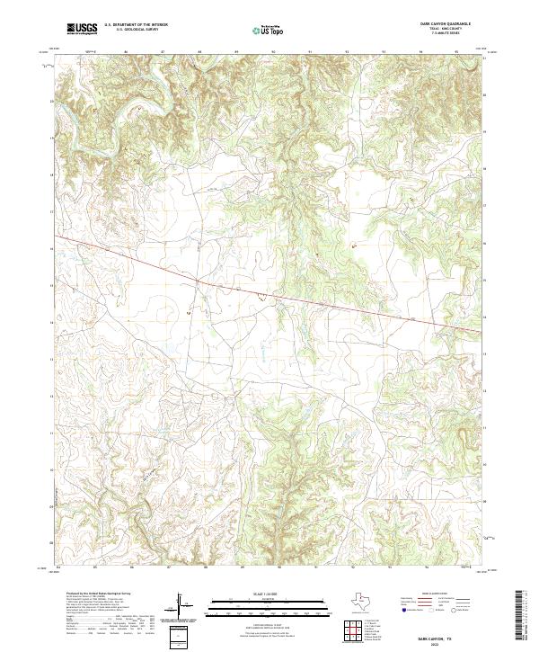
2022 Map of Dark Canyon
USGS Topo · Published 2022About this map
The South Wichita River meanders across the northern reaches of this King County landscape, carving through a region defined by an intricate network of seasonal drainages and canyons. The terrain is marked by significant topographical features such as Dark Canyon and Spring Canyon in the southwest, where the land drops toward the headwaters of N Croton Cr. This environment dictates the placement of rural infrastructure, with Co RD 328 and Co RD 257 following the higher ground between creek beds.
Find a feature on this map
14 named features on this map. Tap any name to fly to it.
Don’t see what you’re looking for? This feature index may not catch every label — zoom into the map to look around manually.
Map Details
Editions of this 2022 Dark Canyon Map
This is the sole edition of this map. No revisions or reprints were ever made.
Other maps of this area

1954 · Lubbock
USGS Topo · 1:250,000

1959 · Bob Creek
USGS Topo · 1:24,000

1966 · Ox Yoke Creek
USGS Topo · 1:24,000

1966 · J Y Ranch
USGS Topo · 1:24,000

1967 · Dark Canyon
USGS Topo · 1:24,000

1967 · Fourmile Hill
USGS Topo · 1:24,000

1967 · Kiowa Peak NW
USGS Topo · 1:24,000

1967 · Kiowa Peak NE
USGS Topo · 1:24,000
1967 · Buzzard Peak
USGS Topo · 1:24,000

1968 · Guthrie
USGS Topo · 1:24,000