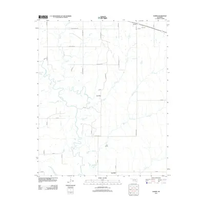
2012 Map of Darwin
USGS Topo · Published 2012About this map
Muddy Boggy Cr meanders through this Atoka County landscape, defining the local hydrology alongside features like the Boggy Cutoff and the Lamey Slash wetland area. The settlement of Darwin occupies the northeastern corner, anchored by the Darwin Cem and surrounded by a network of rural roads such as E Farris Cemetery Rd and S Potubbi Creek Rd. This 2012 survey illustrates a landscape of intermittent water and small lakes, including Hopena Lake, Louie Lake, and Clear Lake. Small community hubs like Lone Pine and Sand Bluff are situated along the secondary road network, which navigates around terrain features like Pine Hollow. The map reveals the intricate drainage patterns of smaller tributaries like Potubbi Cr and Sugar Cr as they feed into the larger creek systems of southeastern Oklahoma.
Find a feature on this map
48 named features on this map. Tap any name to fly to it.
Don’t see what you’re looking for? This feature index may not catch every label — zoom into the map to look around manually.
Map Details
Editions of this 2012 Darwin Map
This is the sole edition of this map. No revisions or reprints were ever made.
Other maps of this area

1901 · Antlers
USGS Topo · 1:125,000

1912 · Antlers
USGS Topo · 1:125,000

1925 · Antlers
USGS Topo · 1:125,000

1950 · Mcalester
USGS Topo · 1:250,000

1957 · Farris
USGS Topo · 1:24,000

1957 · Moyers
USGS Topo · 1:24,000

1957 · Lane
USGS Topo · 1:24,000
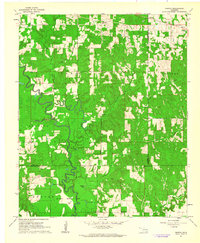
1961 · Darwin
USGS Topo · 1:24,000

1961 · Antlers West
USGS Topo · 1:24,000

1962 · McAlester
USGS Topo · 1:250,000