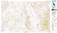
1985 Map of Darwin Hills
USGS Topo · Published 1985About this map
Ballarat and the industrial remnants of the High Desert anchor this mid-1980s look at a landscape defined by extraction and extreme geography. The map documents an era when the Naval Weapons Center occupied a massive swath of the Coso Range, including Coso Hot Springs and Cactus Flat, while traditional mining activities persisted across the Argus Range and Darwin Hills. This edition is particularly valuable for identifying the locations of historic town sites and ruins that had already faded from the active landscape, such as Lookout City (Site), Skidoo (Site), and the Anthony Mill Ruins.
Find a feature on this map
152 named features on this map. Tap any name to fly to it.
Don’t see what you’re looking for? This feature index may not catch every label — zoom into the map to look around manually.
Map Details
Editions of this 1985 Darwin Hills Map
2 editions found
Other maps of this area

1905 · Olancha
USGS Topo · 1:125,000

1906 · Kernville
USGS Topo · 1:125,000

1907 · Olancha
USGS Topo · 1:125,000

1907 · Mt. Whitney
USGS Topo · 1:125,000

1908 · Furnace Creek
USGS Topo · 1:250,000

1908 · Kernville
USGS Topo · 1:125,000

1908 · Ballarat
USGS Topo · 1:250,000

1910 · Furnace Creek
USGS Topo · 1:250,000

1913 · Ballarat
USGS Topo · 1:250,000

1915 · Searles Lake
USGS Topo · 1:250,000