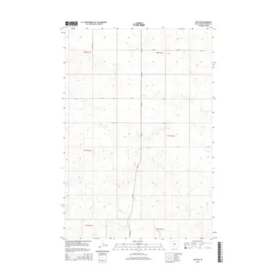
2015 Map of Date NE
USGS Topo · Published 2015About this map
Rabbit Cr meanders through the heart of this Perkins County landscape, carving a low-relief drainage system across the high plains. The area is defined by a sparse but rigid grid of section-line roads, such as Bixby Rd and Scotch Cap Rd, which facilitate movement between isolated ranching outposts. This 2015 data illustrates a traditional Western landscape where water sources remain the primary geographical anchors, including the smaller drainages of Cone Tree Cr and Smith Cr. Small-scale topography is marked by subtle rises and breaks, while the public land survey system divisions indicate the orderly settlement pattern of northern South Dakota. The map provides a look at the modern rural infrastructure, showing the persistence of the traditional township-and-range layout through named routes like 134th St and 132nd St.
Find a feature on this map
15 named features on this map. Tap any name to fly to it.
Don’t see what you’re looking for? This feature index may not catch every label — zoom into the map to look around manually.
Map Details
Editions of this 2015 Date NE Map
This is the sole edition of this map. No revisions or reprints were ever made.
Other maps of this area

1954 · Lemmon
USGS Topo · 1:250,000

1957 · Lemmon
USGS Topo · 1:250,000

1983 · Grandmas Butte
USGS Topo · 1:24,000

1983 · Rabbit Butte
USGS Topo · 1:24,000

1983 · Square Top Butte
USGS Topo · 1:24,000

1983 · Bison
USGS Topo · 1:24,000

1983 · Date NE
USGS Topo · 1:24,000

1983 · Date
USGS Topo · 1:24,000

1983 · Daviston
USGS Topo · 1:24,000

1983 · Owen Lake
USGS Topo · 1:24,000