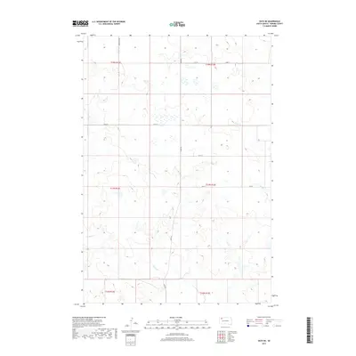
2017 Map of Date NE
USGS Topo · Published 2017About this map
Rabbit Cr winds through the heart of this Perkins County landscape, carving a drainage pattern across a high prairie defined by the Public Land Survey System. The map reveals a remote ranching environment where the grid of the township and range system is strictly maintained by section lines and gravel roads such as Bixby Rd and Scotch Cap Rd. Other seasonal waterways, including Cone Tree Cr and Smith Cr, emphasize the importance of natural drainage in this semi-arid region. This 2017 survey reflects the enduring character of the High Plains, showing how modern access roads like 134th St and 136th St follow the same section boundaries established over a century ago.
Find a feature on this map
16 named features on this map. Tap any name to fly to it.
Don’t see what you’re looking for? This feature index may not catch every label — zoom into the map to look around manually.
Map Details
Editions of this 2017 Date NE Map
This is the sole edition of this map. No revisions or reprints were ever made.
Other maps of this area

1954 · Lemmon
USGS Topo · 1:250,000

1957 · Lemmon
USGS Topo · 1:250,000

1983 · Grandmas Butte
USGS Topo · 1:24,000

1983 · Rabbit Butte
USGS Topo · 1:24,000

1983 · Square Top Butte
USGS Topo · 1:24,000

1983 · Bison
USGS Topo · 1:24,000

1983 · Date NE
USGS Topo · 1:24,000

1983 · Date
USGS Topo · 1:24,000

1983 · Daviston
USGS Topo · 1:24,000

1983 · Owen Lake
USGS Topo · 1:24,000