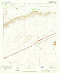
1965 Map of Dateland
USGS Topo · Published 1966About this map
The Southern Pacific railroad corridor defines the development of this arid landscape, running parallel to the northern edge of the Luke Air Force Range. At the heart of the region is Dateland, a settlement shaped by its dual role as a transportation hub and a support center for the nearby Dateland Airfield. The map reveals the infrastructure of a mid-century desert community, featuring a Control Tower at the airfield, the Dateland Sch, and a Highway Maintenance Yard.
Find a feature on this map
19 named features on this map. Tap any name to fly to it.
Don’t see what you’re looking for? This feature index may not catch every label — zoom into the map to look around manually.
Map Details
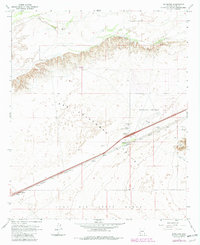
Editions of this 1965 Dateland Map
2 editions found
Other maps of this area

1927 · Aguila Mountains
USGS Topo · 1:48,000

1927 · Kim
USGS Topo · 1:62,500

1929 · Aztec
USGS Topo · 1:62,500

1930 · Aguila Mountains
USGS Topo · 1:62,500

1930 · Stoval
USGS Topo · 1:62,500

1931 · Kim
USGS Topo · 1:62,500

1950 · Stoval
USGS Topo · 1:62,500

1950 · Aztec
USGS Topo · 1:62,500

1953 · Ajo
USGS Topo · 1:250,000

1957 · Ajo
USGS Topo · 1:250,000