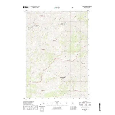
2020 Map of Dave Lewis Peak
USGS Topo · Published 2020About this map
Dave Lewis Peak stands as the central high point of this Idaho wilderness, where the borders of the Payette National Forest and Salmon National Forest meet. The landscape is defined by the deep drainage of Big Creek, which flows past the Taylor Ranch Landing Area and through a prominent Gorge near Soldier Bar. This area remains largely roadless, relying on the Soldier Bar USFS Airport for backcountry access. The intricate system of drainages, including Goat Creek, Sammy Gulch, and Bernard Cr, highlights the steep, vertical nature of the Frank Church-River of No Return Wilderness area. Land surveyors have marked the terrain with numerous protracted blocks, while geographical landmarks like Big Creek Ridge and Eagan Point provide essential navigation points in this isolated mountain territory.
Find a feature on this map
50 named features on this map. Tap any name to fly to it.
Don’t see what you’re looking for? This feature index may not catch every label — zoom into the map to look around manually.
Map Details
Editions of this 2020 Dave Lewis Peak Map
This is the sole edition of this map. No revisions or reprints were ever made.
Other maps of this area

1930 · Casto
USGS Topo · 1:125,000

1956 · Elk City
USGS Topo · 1:250,000

1957 · Challis
USGS Topo · 1:250,000

1960 · Elk City
USGS Topo · 1:250,000

1960 · Challis
USGS Topo · 1:250,000

1962 · Mormon Mtn
USGS Topo · 1:24,000

1962 · Vinegar Hill
USGS Topo · 1:24,000

1962 · Bear Creek Point
USGS Topo · 1:24,000

1962 · Puddin Mtn
USGS Topo · 1:24,000

1962 · Papoose Peak
USGS Topo · 1:24,000