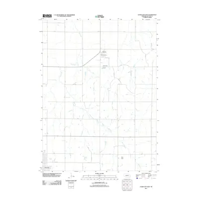
2011 Map of David City East
USGS Topo · Published 2011About this map
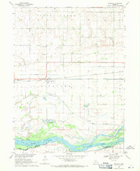
Octavia sits at the center of this agricultural landscape in Butler County, where the Octavia Post Office serves as a local anchor for the surrounding farming community. The terrain is defined by the winding course of Bone Creek, which meanders from the northwest toward the southeast, cutting through the grid-iron pattern of rural roads such as 43 RD and 38 RD. Man-made water management is evident at the Brezina Reservoir, held by the Brezina Dam, providing a critical water resource for the region. To the southwest, the edge of David City begins to appear, signaling the transition from open fields to more concentrated town development. This survey illustrates the persistent rural character of eastern Nebraska, where industrial utility is represented by the Butler County Landfill and a network of named local routes like Road Q And R and Road RS.
Find a feature on this map
19 named features on this map. Tap any name to fly to it.
Don’t see what you’re looking for? This feature index may not catch every label — zoom into the map to look around manually.
Map Details
Editions of this 2011 David City East Map
This is the sole edition of this map. No revisions or reprints were ever made.
Other maps of this area

1899 · Wahoo
USGS Topo · 1:125,000

1899 · David City
USGS Topo · 1:125,000

1955 · Fremont
USGS Topo · 1:250,000

1957 · Fremont
USGS Topo · 1:250,000

1958 · Fremont
USGS Topo · 1:250,000
1965 · Brainard
USGS Topo · 1:24,000
1965 · Garrison
USGS Topo · 1:24,000

1968 · Bruno
USGS Topo · 1:24,000
1968 · David City West
USGS Topo · 1:24,000
1968 · Richland
USGS Topo · 1:24,000