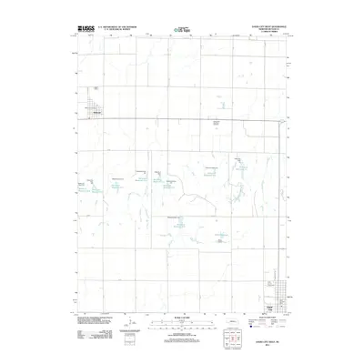
2011 Map of David City West
USGS Topo · Published 2011About this map
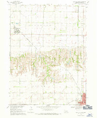
Agricultural lands of Butler County define this prairie landscape, where the village of Bellwood stands in the northwest and the western edge of David City anchors the southeast corner. The drainage of Deer Creek is managed by an extensive network of earthen works, including Birkel Dam and numerous detention structures such as Detention Dam 5-H and Detention Dam 6-F. These projects created a series of water bodies, notably Birkel Reservoir and the numbered Bellwood reservoirs, which dominate the central terrain.
Find a feature on this map
36 named features on this map. Tap any name to fly to it.
Don’t see what you’re looking for? This feature index may not catch every label — zoom into the map to look around manually.
Map Details
Editions of this 2011 David City West Map
This is the sole edition of this map. No revisions or reprints were ever made.
Other maps of this area

1899 · David City
USGS Topo · 1:125,000

1955 · Fremont
USGS Topo · 1:250,000

1957 · Fremont
USGS Topo · 1:250,000

1958 · Fremont
USGS Topo · 1:250,000

1958 · Columbus SE
USGS Topo · 1:24,000

1958 · Columbus
USGS Topo · 1:24,000
1965 · Brainard
USGS Topo · 1:24,000
1965 · Garrison
USGS Topo · 1:24,000
1965 · Rising City
USGS Topo · 1:24,000
1968 · David City West
USGS Topo · 1:24,000