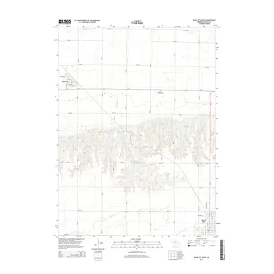
2014 Map of David City West
USGS Topo · Published 2014About this map
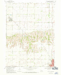
Bellwood and the northwestern outskirts of David City anchor this Butler County landscape, where the flat agricultural plains of the Platte River valley meet more complex terrain to the south. The area is defined by an extensive series of water management features, including a cluster of numbered basins such as Bellwood Reservoir 5-K and Bellwood Reservoir 4-L, along with the Birkel Reservoir. These catchments follow the natural drainage of Deer Cr and surrounding draws, illustrating the intersection of modern engineering and Nebraska's prairie topography. Local history and genealogy interests are centered on the village of Bellwood, which maintains its traditional street grid including Pioneer St and Taylor St, and the nearby Saints Peter and Mary Cem. In David City, the transition from residential areas to an industrial fringe is visible along Industrial Dr and Maplewood Dr.
Find a feature on this map
48 named features on this map. Tap any name to fly to it.
Don’t see what you’re looking for? This feature index may not catch every label — zoom into the map to look around manually.
Map Details
Editions of this 2014 David City West Map
This is the sole edition of this map. No revisions or reprints were ever made.
Other maps of this area

1899 · David City
USGS Topo · 1:125,000

1955 · Fremont
USGS Topo · 1:250,000

1957 · Fremont
USGS Topo · 1:250,000

1958 · Fremont
USGS Topo · 1:250,000

1958 · Columbus SE
USGS Topo · 1:24,000

1958 · Columbus
USGS Topo · 1:24,000
1965 · Brainard
USGS Topo · 1:24,000
1965 · Garrison
USGS Topo · 1:24,000
1965 · Rising City
USGS Topo · 1:24,000
1968 · David City West
USGS Topo · 1:24,000