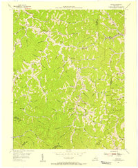
1954 Map of David
USGS Topo · Published 1956About this map
The Licking River and its intricate drainage network define this 1950s landscape across the intersection of Magoffin, Floyd, Breathitt, and Knott counties. Small settlements like Fredville, Arthurmabel, and Gunlock are situated along narrow valley floors, connected by winding roads and the Chesapeake and Ohio Railroad. This era shows a community-focused geography, with numerous small educational institutions such as the Allen School, Lick Fork School, and Forks of Trace School serving dispersed families in the hollers. The map also records early industrial markers, including an Oil Well and the presence of gas wells, alongside the Waldo Wayside Church. Topographical data was synthesized from aerial photographs and local coal company maps, reflecting the area's economic reliance on the underlying terrain.
Find a feature on this map
89 named features on this map. Tap any name to fly to it.
Don’t see what you’re looking for? This feature index may not catch every label — zoom into the map to look around manually.
Map Details
Editions of this 1954 David Map
3 editions found
Other maps of this area

1886 · Prestonsburg
USGS Topo · 1:125,000

1889 · Salyersville
USGS Topo · 1:125,000

1890 · Whitesburg
USGS Topo · 1:125,000

1891 · Hazard
USGS Topo · 1:125,000

1891 · Salyersville
USGS Topo · 1:125,000

1892 · Whitesburg
USGS Topo · 1:125,000

1892 · Prestonsburg
USGS Topo · 1:125,000

1899 · Salyersville
USGS Topo · 1:125,000

1912 · Hindman
USGS Topo · 1:48,000

1914 · Troublesome
USGS Topo · 1:62,500