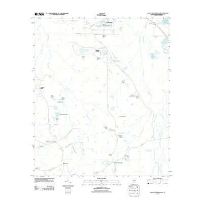
2011 Map of Davis Crossroads
USGS Topo · Published 2011About this map
Davis Crossroads and the surrounding rural communities of Red Level and Robinson Crossroads anchor this southern Alabama landscape at the start of the 2010s. The area is defined by its extensive network of watercourses and man-made impoundments, including Sandy Creek, Waller Creek, and Catoma Creek. Numerous small-scale dams and reservoirs reflect a legacy of local agricultural water management, evidenced by features such as the Arrington Lake Number 1 and the W C Gibson Lake. For genealogists and local historians, the map is particularly valuable for its documentation of numerous burial sites, from the Howell Cemetery in the north to the Jackson Cemetery and Orme Cemetery in the south. The transition from traditional farmsteads like Hobbie Farm to more contemporary residential pockets like Rolling Hills and Rolling Lakes illustrates the gradual changing character of this Montgomery County countryside.
Find a feature on this map
63 named features on this map. Tap any name to fly to it.
Don’t see what you’re looking for? This feature index may not catch every label — zoom into the map to look around manually.
Map Details
Editions of this 2011 Davis Crossroads Map
This is the sole edition of this map. No revisions or reprints were ever made.
Other maps of this area

1927 · Montgomery
USGS Topo · 1:48,000

1930 · Montgomery
USGS Topo · 1:62,500

1953 · Montgomery
USGS Topo · 1:250,000

1956 · Montgomery
USGS Topo · 1:250,000

1957 · Montgomery
USGS Topo · 1:250,000

1957 · Letohatchee
USGS Topo · 1:62,500

1958 · Montgomery
USGS Topo · 1:62,500

1958 · Montgomery South
USGS Topo · 1:24,000

1958 · Mount Meigs
USGS Topo · 1:62,500

1971 · Davis Crossroads
USGS Topo · 1:24,000