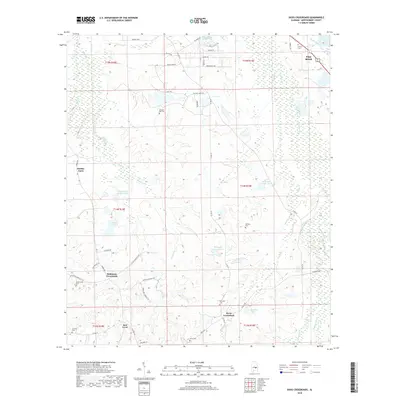
2018 Map of Davis Crossroads
USGS Topo · Published 2018About this map
Pike Road and the surrounding rural landscape of Montgomery County are documented in this 2018 survey, which highlights the intersection of historic agricultural life and growing suburban developments. Small family-named landmarks and old burial grounds like Bethany Cem and Howell Cem are scattered among the headwaters of Catoma Cr and Sandy Cr. The map captures a high density of named crossroads and farmsteads, including Robinson Crossroads and Hobbie Farm, reflecting a settlement pattern built around important local junctions.
Find a feature on this map
57 named features on this map. Tap any name to fly to it.
Don’t see what you’re looking for? This feature index may not catch every label — zoom into the map to look around manually.
Map Details
Editions of this 2018 Davis Crossroads Map
This is the sole edition of this map. No revisions or reprints were ever made.
Other maps of this area

1927 · Montgomery
USGS Topo · 1:48,000

1930 · Montgomery
USGS Topo · 1:62,500

1953 · Montgomery
USGS Topo · 1:250,000

1956 · Montgomery
USGS Topo · 1:250,000

1957 · Montgomery
USGS Topo · 1:250,000

1957 · Letohatchee
USGS Topo · 1:62,500

1958 · Montgomery
USGS Topo · 1:62,500

1958 · Montgomery South
USGS Topo · 1:24,000

1958 · Mount Meigs
USGS Topo · 1:62,500

1971 · Davis Crossroads
USGS Topo · 1:24,000