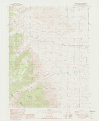
1987 Map of Davis Mountain
USGS Topo · Published 1987About this map
Davis Mountain dominates the high-altitude landscape of the eastern Sierra region in the late 1980s, straddling the rugged border between Nevada and California. The map records the transition from the forested heights of the Inyo National Forest down into the arid expanse of Fish Lake Valley. Numerous drainages carve through the terrain, including Chiatovich Creek, which features a Gaging Station and evidence of previous activity noted as Ruins.
Find a feature on this map
20 named features on this map. Tap any name to fly to it.
Don’t see what you’re looking for? This feature index may not catch every label — zoom into the map to look around manually.
Map Details
Editions of this 1987 Davis Mountain Map
2 editions found
Other maps of this area

1917 · White Mountain
USGS Topo · 1:125,000

1947 · Mariposa
USGS Topo · 1:250,000

1948 · Mariposa
USGS Topo · 1:250,000

1957 · Mariposa
USGS Topo · 1:250,000

1962 · Benton
USGS Topo · 1:62,500

1962 · Mt. Barcroft
USGS Topo · 1:62,500

1962 · White Mtn. Peak
USGS Topo · 1:62,500

1963 · Mariposa
USGS Topo · 1:250,000

1963 · Davis Mountain
USGS Topo · 1:62,500
1987 · Volcanic Hills West
USGS Topo · 1:24,000