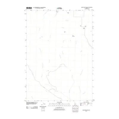
2010 Map of Davis Mountain
USGS Topo · Published 2010About this map
Davis Mountain serves as the focal point for this Idaho landscape, where the high desert meets a complex network of seasonal drainages and essential water sources. The map highlights the intersection of livestock and ranching history at Dean Camp, positioned near several named gulches and draws. This region is characterized by its vital water features, including Big Spring, Deer Spring, Hobby Spring, and Erma Spring, which have long supported the arid rangelands. The hydrology is dominated by the meandering paths of Clover Creek and the East Fork Clover Creek, alongside numerous tributaries like Dairy Creek and Sourdough Creek. Transportation through this remote terrain is centered on Hill City Rd, which cuts through the southwestern section. The topographic detail reveals a landscape of flats and gulches, from Little Flat to Perkins Gulch, illustrating the intricate geography that defines this part of Gooding County.
Find a feature on this map
24 named features on this map. Tap any name to fly to it.
Don’t see what you’re looking for? This feature index may not catch every label — zoom into the map to look around manually.
Map Details
Editions of this 2010 Davis Mountain Map
This is the sole edition of this map. No revisions or reprints were ever made.
Other maps of this area

1892 · Camas Prairie
USGS Topo · 1:125,000

1893 · Camas Prairie
USGS Topo · 1:125,000

1955 · Hailey
USGS Topo · 1:250,000

1957 · Fairfield
USGS Topo · 1:62,500

1957 · Davis Mountain
USGS Topo · 1:62,500

1958 · King Hill
USGS Topo · 1:62,500

1959 · Hailey
USGS Topo · 1:250,000

1962 · Hailey
USGS Topo · 1:250,000

1963 · Hill City
USGS Topo · 1:24,000
1986 · Fir Grove Mountain
USGS Topo · 1:24,000