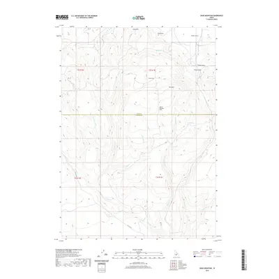
2020 Map of Davis Mountain
USGS Topo · Published 2020About this map
Davis Mtn and the Mount Bennett Hills anchor this high-desert landscape along the boundary of Camas and Gooding Counties. The northern portion of the map transitions into the southern edge of the Camas Prairie, a distinct geographical basin characterized by its wide, open terrain. This 2020 survey illustrates a complex network of seasonal drainages and permanent water sources, including Big Spring, Hobby Spring, and Emma Spring, which historically supported ranching and movement through the region. Transportation is primarily defined by Hill City Rd and various secondary roads that navigate the draws and gulches, such as Long Gulch and Timber Gulch. The topographic detail reveals the intricate erosion patterns of Sourdough Cr and Squaw Cr, showing how water has carved the approach to Little Flat over time.
Find a feature on this map
28 named features on this map. Tap any name to fly to it.
Don’t see what you’re looking for? This feature index may not catch every label — zoom into the map to look around manually.
Map Details
Editions of this 2020 Davis Mountain Map
This is the sole edition of this map. No revisions or reprints were ever made.
Other maps of this area

1892 · Camas Prairie
USGS Topo · 1:125,000

1893 · Camas Prairie
USGS Topo · 1:125,000

1955 · Hailey
USGS Topo · 1:250,000

1957 · Fairfield
USGS Topo · 1:62,500

1957 · Davis Mountain
USGS Topo · 1:62,500

1958 · King Hill
USGS Topo · 1:62,500

1959 · Hailey
USGS Topo · 1:250,000

1962 · Hailey
USGS Topo · 1:250,000

1963 · Hill City
USGS Topo · 1:24,000
1986 · Fir Grove Mountain
USGS Topo · 1:24,000