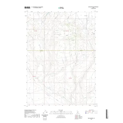
2023 Map of Davis Mountain
USGS Topo · Published 2023About this map
Mount Bennett Hills rise across the center of this terrain, marking the boundary between the Camas Prairie to the north and the drainage basins of the Snake River plain to the south. This 2023 survey by the U.S. Geological Survey captures the intricate network of canyons and gulches that define the high desert landscape of Idaho. Water sources are scarce but significant, noted by several named springs including Big Spring, Hobby Spring, and Beer Spring.
Find a feature on this map
29 named features on this map. Tap any name to fly to it.
Don’t see what you’re looking for? This feature index may not catch every label — zoom into the map to look around manually.
Map Details
Editions of this 2023 Davis Mountain Map
This is the sole edition of this map. No revisions or reprints were ever made.
Other maps of this area

1892 · Camas Prairie
USGS Topo · 1:125,000

1893 · Camas Prairie
USGS Topo · 1:125,000

1955 · Hailey
USGS Topo · 1:250,000

1957 · Fairfield
USGS Topo · 1:62,500

1957 · Davis Mountain
USGS Topo · 1:62,500

1958 · King Hill
USGS Topo · 1:62,500

1959 · Hailey
USGS Topo · 1:250,000

1962 · Hailey
USGS Topo · 1:250,000

1963 · Hill City
USGS Topo · 1:24,000
1986 · Fir Grove Mountain
USGS Topo · 1:24,000