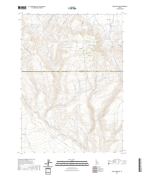
2024 Map of Davis Mountain
USGS Topo · Published 2024About this map
The Mount Bennett Hills dominate this high-desert landscape in south-central Idaho, where the high-altitude Camas Prairie meets the volcanic slopes of the Snake River Plain periphery. The topographic detail follows a complex drainage network including Sourdough Creek and Clover Creek, which carve deep through the uplands before feeding toward the Snake River drainage to the south. Historically, this terrain has been critical for seasonal livestock grazing, a fact reflected in the presence of seasonal water sources like Dairy Creek and named springs such as Big Spring and Hobby Spring.
Find a feature on this map
25 named features on this map. Tap any name to fly to it.
Don’t see what you’re looking for? This feature index may not catch every label — zoom into the map to look around manually.
Map Details
Editions of this 2024 Davis Mountain Map
This is the sole edition of this map. No revisions or reprints were ever made.
Other maps of this area

1892 · Camas Prairie
USGS Topo · 1:125,000

1893 · Camas Prairie
USGS Topo · 1:125,000

1955 · Hailey
USGS Topo · 1:250,000

1957 · Fairfield
USGS Topo · 1:62,500

1957 · Davis Mountain
USGS Topo · 1:62,500

1958 · King Hill
USGS Topo · 1:62,500

1959 · Hailey
USGS Topo · 1:250,000

1962 · Hailey
USGS Topo · 1:250,000

1963 · Hill City
USGS Topo · 1:24,000
1986 · Fir Grove Mountain
USGS Topo · 1:24,000