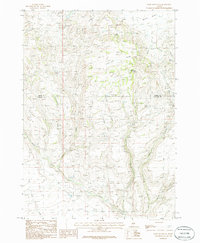
1986 Map of Davis Mountain
USGS Topo · Published 1986About this map
Davis Mountain dominates the high plateau country of south-central Idaho, where the boundary between Camas and Gooding Counties cuts across the sagebrush and rangeland. This mid-1980s provisional survey illustrates a landscape defined by seasonal water and intricate drainage systems, including the headwaters of Cottonwood Creek and the winding course of Clover Creek. The topography is marked by several named water sources such as Big Spring, Erma Spring, and Hobby Spring, which were vital for livestock and early land use.
Find a feature on this map
23 named features on this map. Tap any name to fly to it.
Don’t see what you’re looking for? This feature index may not catch every label — zoom into the map to look around manually.
Map Details
Editions of this 1986 Davis Mountain Map
This is the sole edition of this map. No revisions or reprints were ever made.
Other maps of this area

1892 · Camas Prairie
USGS Topo · 1:125,000

1893 · Camas Prairie
USGS Topo · 1:125,000

1955 · Hailey
USGS Topo · 1:250,000

1957 · Fairfield
USGS Topo · 1:62,500

1957 · Davis Mountain
USGS Topo · 1:62,500

1958 · King Hill
USGS Topo · 1:62,500

1959 · Hailey
USGS Topo · 1:250,000

1962 · Hailey
USGS Topo · 1:250,000

1963 · Hill City
USGS Topo · 1:24,000
1986 · Fir Grove Mountain
USGS Topo · 1:24,000