
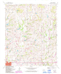
1965 Map of Davis
USGS Topo · Published 1966About this map
The town of Davis anchors this mid-century survey of south-central Oklahoma, showcasing a landscape transitioning between traditional agriculture and intensive petroleum extraction. The local economy is visibly defined by the Northeast Davis Oil Field, Chigley Oil Field, and Northwest Sulphur Oil Field, with numerous Oil Wells and a Gas Well scattered across the terrain. Public life centers around the High Sch and Post Office in Davis, while the rural landscape is dotted with smaller communities like Chigley and Iona.
Find a feature on this map
35 named features on this map. Tap any name to fly to it.
Don’t see what you’re looking for? This feature index may not catch every label — zoom into the map to look around manually.
Map Details
Editions of this 1965 Davis Map
2 editions found
Other maps of this area

1898 · Pauls Valley
USGS Topo · 1:125,000

1901 · Stonewall
USGS Topo · 1:125,000

1901 · Tishomingo
USGS Topo · 1:125,000

1901 · Ardmore
USGS Topo · 1:125,000

1902 · Pauls Valley
USGS Topo · 1:125,000

1918 · Ardmore
USGS Topo · 1:125,000

1957 · Ardmore
USGS Topo · 1:250,000

1963 · Ardmore
USGS Topo · 1:250,000

1963 · Sulphur South
USGS Topo · 1:24,000

1964 · Turner Falls
USGS Topo · 1:24,000