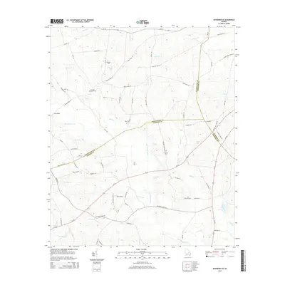
2014 Map of Davisboro SE
USGS Topo · Published 2014About this map
Whitfield Cem and Pleasant Springs Cem are among several family and community burial grounds that define the rural character of this intersection between Washington, Jefferson, and Johnson counties. The landscape is deeply carved by the Little Ohoopee River and its numerous tributaries, including Hurricane Br, Nealey Cr, and Smith Cr. This network of waterways shaped the early settlement patterns and road placements, as seen at the crossing of News Bridge.
Find a feature on this map
60 named features on this map. Tap any name to fly to it.
Don’t see what you’re looking for? This feature index may not catch every label — zoom into the map to look around manually.
Map Details
Editions of this 2014 Davisboro SE Map
This is the sole edition of this map. No revisions or reprints were ever made.
Other maps of this area

1957 · Macon
USGS Topo · 1:250,000

1958 · Macon
USGS Topo · 1:250,000

1964 · Macon
USGS Topo · 1:250,000

1971 · Dellwood
USGS Topo · 1:24,000
1973 · Louisville South
USGS Topo · 1:24,000
1973 · Davisboro SE
USGS Topo · 1:24,000
1973 · Riddleville
USGS Topo · 1:24,000
1973 · Harrison
USGS Topo · 1:24,000
1973 · Wadley
USGS Topo · 1:24,000

1974 · Kite
USGS Topo · 1:24,000