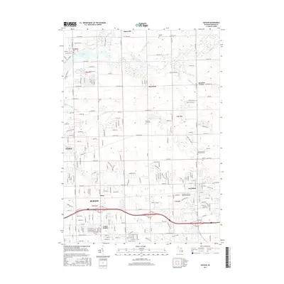
2017 Map of Davison
USGS Topo · Published 2017About this map
The Flint River meanders across the northern half of this landscape, fed by a dense network of tributaries including Buttercup Creek, Parker-Seathan Drain, and Clark Drain. This 2017 survey details the urban expansion of Davison and Burton as they bridge the gap between the metropolitan reach of Flint and the rural outskirts of Richfield Center and Rogersville. The map captures a transition from high-density residential developments in Lapeer Heights and Belsay to the more open township lands north of E Richfield Rd. Local historical and genealogical landmarks are prominent, notably the Eastwood Colonial Memorial Gardens and Richfield Union Cem. The southeastern quadrant is defined by the infrastructure of the Athelone Williams Memorial Airport and the riparian corridor of Kearsley Creek, while the northeast retains a distinctive agricultural character structured by the grid of the Public Land Survey System.
Find a feature on this map
104 named features on this map. Tap any name to fly to it.
Don’t see what you’re looking for? This feature index may not catch every label — zoom into the map to look around manually.
Map Details
Editions of this 2017 Davison Map
This is the sole edition of this map. No revisions or reprints were ever made.
Other maps of this area

1920 · Flint
USGS Topo · 1:62,500

1920 · Holly
USGS Topo · 1:62,500

1922 · Holly
USGS Topo · 1:62,500

1922 · Flint
USGS Topo · 1:62,500

1943 · Holly
USGS Topo · 1:62,500

1943 · Flint
USGS Topo · 1:62,500

1945 · Hadley
USGS Topo · 1:24,000

1954 · Detroit
USGS Topo · 1:250,000

1954 · Flint
USGS Topo · 1:250,000

1958 · Flint
USGS Topo · 1:250,000