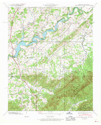
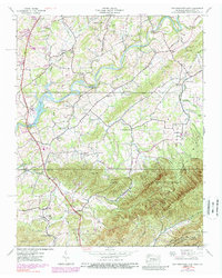
1939 Map of Davy Crockett Lake
USGS Topo · Published 1968About this map
Davy Crockett Lake sits at the heart of this landscape, formed by the Greeneville Dam along the winding Nolichucky River. The map reveals a deeply settled rural corridor in Greene County during the late 1930s, where small community life is documented through a dense network of country schools like Sunnydale Sch and Links Sch, and numerous local churches such as Amity Ch and Bethesda Ch. Industry and institutional presence are visible at Staunton Mill and the Experiment Station, while the Orphanage near Camp Creek Sch speaks to the social history of the era.
Find a feature on this map
66 named features on this map. Tap any name to fly to it.
Don’t see what you’re looking for? This feature index may not catch every label — zoom into the map to look around manually.
Map Details
Editions of this 1939 Davy Crockett Lake Map
5 editions found
Other maps of this area

1892 · Greeneville
USGS Topo · 1:125,000

1894 · Asheville
USGS Topo · 1:125,000

1896 · Greeneville
USGS Topo · 1:125,000

1901 · Asheville
USGS Topo · 1:125,000

1904 · Greeneville
USGS Topo · 1:125,000

1935 · Paint Rock
USGS Topo · 1:24,000

1935 · Mosheim
USGS Topo · 1:24,000

1935 · Cedar Creek
USGS Topo · 1:24,000

1935 · Hot Springs
USGS Topo · 1:24,000

1936 · Greystone
USGS Topo · 1:24,000