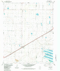
1984 Map of Dawn
USGS Topo · Published 1984About this map
Dawn serves as the focal point of this Panhandle landscape, situated along the corridor of the Atchison Topeka and Santa Fe railroad. This 1984 survey captures a rural Texas economy anchored by rail transport and large-scale agriculture, evidenced by several Storage Bins and a Landing Strip carved into the flat terrain. The border between Deaf Smith and Randall Counties bisects the region, marked in part by an Indefinite Boundary through the drainage areas of the southeast.
Find a feature on this map
15 named features on this map. Tap any name to fly to it.
Don’t see what you’re looking for? This feature index may not catch every label — zoom into the map to look around manually.
Map Details
Editions of this 1984 Dawn Map
This is the sole edition of this map. No revisions or reprints were ever made.
Other maps of this area

1954 · Tucumcari
USGS Topo · 1:250,000

1954 · Clovis
USGS Topo · 1:250,000

1958 · Clovis
USGS Topo · 1:250,000

1958 · Tucumcari
USGS Topo · 1:250,000

1961 · Buffalo Lake
USGS Topo · 1:62,500

1962 · Wildorado
USGS Topo · 1:62,500

1965 · Allison Ranch
USGS Topo · 1:24,000

1971 · Hereford NE
USGS Topo · 1:24,000

1971 · Hereford SE
USGS Topo · 1:24,000
1984 · Bivins Lake
USGS Topo · 1:24,000