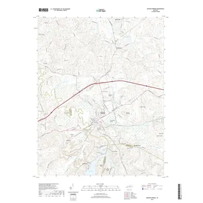
2019 Map of Dawson Springs
USGS Topo · Published 2019About this map
The Tradewater River carves a winding path through this corner of Kentucky, where the boundaries of Hopkins, Caldwell, and Christian counties converge. The town of Dawson Springs serves as the central hub, characterized by a grid of streets like W Arcadia Ave and E Hall St that transition into the wooded ridges and bottomlands of the surrounding countryside. Significant landmarks include the Tradewater Airport and the expansive waters of Lake Beshear to the south. The landscape is defined by its numerous springs and hollows, such as Lick Creek Spring and Blue Hole Hollow, reflecting the region's complex hydrology. Genealogists will find a wealth of local history at sites like Rosedale Cem, Menser Cem, and McNeely Cem, which are scattered among the ridges of Coats Hill and Purdy Hill.
Find a feature on this map
131 named features on this map. Tap any name to fly to it.
Don’t see what you’re looking for? This feature index may not catch every label — zoom into the map to look around manually.
Map Details
Editions of this 2019 Dawson Springs Map
This is the sole edition of this map. No revisions or reprints were ever made.
Other maps of this area

1907 · Earlington
USGS Topo · 1:48,000

1908 · Princeton
USGS Topo · 1:62,500

1909 · Dawson Springs
USGS Topo · 1:48,000

1909 · Earlington
USGS Topo · 1:62,500

1909 · Providence
USGS Topo · 1:62,500

1910 · Princeton
USGS Topo · 1:62,500

1911 · Dawson Springs
USGS Topo · 1:62,500

1953 · Dawson Springs SE
USGS Topo · 1:24,000

1953 · Dawson Springs SW
USGS Topo · 1:24,000

1954 · Evansville
USGS Topo · 1:250,000