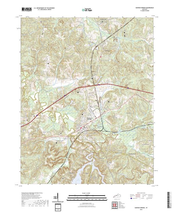
2022 Map of Dawson Springs
USGS Topo · Published 2022About this map
The Tradewater River winds through this West Kentucky landscape, defining the boundaries where Hopkins, Caldwell, and Christian Counties meet. Modern infrastructure like the Tradewater Airport and the CSX Transportation rail line sit alongside deep-rooted rural communities such as Charleston and Sixth Vein. The map reveals a high density of family and community burial grounds, including Lick Creek Cem Number 1, Matt Young Cem, and Bishop Cem, which are vital markers for genealogical research in this region. To the south, the waters of Lake Beshear dominate the terrain near Lakeshore, while the wetland areas of Maple Swamp and Caney Creek indicate the low-lying, water-rich nature of the river valley. Distinctive landforms such as Penitentiary Bend and Coatney Ridge provide a clear view of the area's varied topography.
Find a feature on this map
153 named features on this map. Tap any name to fly to it.
Don’t see what you’re looking for? This feature index may not catch every label — zoom into the map to look around manually.
Map Details
Editions of this 2022 Dawson Springs Map
This is the sole edition of this map. No revisions or reprints were ever made.
Other maps of this area

1907 · Earlington
USGS Topo · 1:48,000

1908 · Princeton
USGS Topo · 1:62,500

1909 · Dawson Springs
USGS Topo · 1:48,000

1909 · Earlington
USGS Topo · 1:62,500

1909 · Providence
USGS Topo · 1:62,500

1910 · Princeton
USGS Topo · 1:62,500

1911 · Dawson Springs
USGS Topo · 1:62,500

1953 · Dawson Springs SE
USGS Topo · 1:24,000

1953 · Dawson Springs SW
USGS Topo · 1:24,000

1954 · Evansville
USGS Topo · 1:250,000